
The world’s largest polar research expedition is currently underway in the Arctic. The year-long mission, known as the Multidisciplinary drifting Observatory for the Study of Arctic Climate (MOSAiC), involves 600 people from 19 countries. From a ship trapped in the sea ice, scientists are taking a diverse range of measurements that could help to transform climate models. Carbon Brief’s science writer Daisy Dunne joined the expedition for its first six weeks in the autumn of 2019. This is the first of four articles focused on MOSAiC research.
Landing a 12-tonne helicopter on floating sea ice in the Arctic Ocean is no easy task. But the Russian research crew on this 14-seater Mi-8 have a surprisingly simple trick to make the job easier. As the helicopter approaches the ice, a crew member throws open the door and kicks out an old car tyre.
The crew watch as the tyre falls to the ice below. The black of the tyre stands in contrast to the grey and bluish tones of the sea ice and the sky above, giving depth to the seemingly flat landscape. This reference point helps the pilots to work out how far they are from the ice surface.
As the helicopter approaches the ice and hovers just above its surface, Dr Tomasz Petrovsky, a sea-ice specialist from the Arctic and Antarctic Research Institute (AARI) in St Petersburg, jumps out onto the ice and uses a hand drill to burrow through to the ocean below.
The rest of the research team look on intently. The amount of time it takes to drill through the ice is a good indicator of how thick it is. Petrovsky gives a thumbs up, signalling that the ice is thick enough for the research team to safely get out on the ice and start collecting data.
In the -6C chill, a team of six researchers pile out onto the ice and begin to take more thickness measurements as the helicopter waits nearby. No human has set foot on this chunk of ice before, meaning each step forward poses a potential risk. The ice surface is covered by several centimetres of snow, which could be concealing cracks or stretches of thin ice.
To navigate the ice safely, the research team keep a close eye on their surroundings. The presence of jagged, tall structures sticking up from the ice surface help the researchers to identify areas of thick ice known as “pressure ridges”. The colour of the ice, too, can give an indication of its thickness. Thin ice tends to appear darker in colour because it is more translucent and, therefore, shows more of the murky ocean below.
“Did you see the bear tracks?” Jakob Belter, a sea ice PhD student at the Alfred Wegener Institute (AWI) in Germany, shouts above the whirring of the helicopter blades. Only a couple of metres away, a set of large round paw prints have been left in the snow. Polar bears are widely considered to be one of the largest threats to the safety of scientists on the sea ice. Up ahead, an armed polar bear guard keeps watch of the horizon.

Jan Rohde and Jakob Belter take ice thickness measurements in front of an Mi-8 helicopter in the Central Arctic Ocean. Credit: Daisy Dunne for Carbon Brief
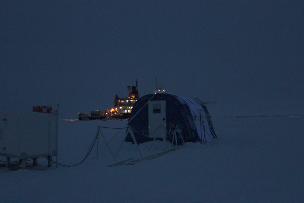
The researchers are trying to find chunks of sea ice, known as ice floes, that could be large and thick enough to support a vast array of scientific equipment for an entire year. The chosen ice floes will act as the scaffolding for a network of floating research stations. These stations will play a key role in MOSAiC, one of the largest and most complex Arctic research expeditions ever attempted.
During its year-long voyage, the MOSAiC “ice camp” will host around 600 people from 19 countries. A network of research stations will surround the camp. These scientists will study changes to the sea ice, ocean, atmosphere and ecosystem – in the hope of gaining a better understanding of why the Arctic is changing so rapidly. In turn, this vast array of new data will be used to help improve the climate models used to project future changes.
At the heart of the camp will be the Polarstern, a German icebreaker that will deliberately freeze itself into the sea ice. The ship and its surrounding network of research stations will then spend a year suspended in the ice, passively drifting across the Arctic.
There is no knowing for certain where the ice will take them, but the researchers hope to eventually end up in the Fram Strait, an ocean passage located between Greenland and Svalbard, a Norwegian Arctic island.
Map showing the Polarstern’s route from its departure from Tromso on 20 September 2019 to around 85 degrees north in the Central Arctic Ocean, where it attached itself to an ice floe on 6 October 2019 (red). The thatched arrow illustrates the area that the ship might drift over on its year-long journey, which will end near the Fram Strait. Credit: Tom Prater for Carbon Brief
Scientists and supplies will be ferried to and from the ice camp by other research vessels from Russia, China and Sweden.
Carbon Brief has been invited to join the expedition for its first six weeks onboard one of these vessels, a Russian research ship named the Akademik Fedorov. This vessel follows the Polarstern from its starting point in Tromso, Norway to within a few hundred miles of the north pole, to assist with the expedition’s set-up phase.
Ice bound
The departure of the Akademik Fedorov from Tromso is delayed a day by a shipping container of scientific equipment arriving late from Colorado.
Onboard, the research team get adjusted to their new surroundings. The ship has seven levels, which are filled by private cabins, research labs, a mess hall, a ping-pong room and a surprisingly spacious sauna. Every room is stifling warm, and every door sign and safety notice is in Russian.
Scientists are woken over a tannoy at 7am each morning with the greeting: “Expeditionists, wake up!” Meal times are regimented, with breakfast starting at 7.30am, lunch at 11.30am, tea time at 3.30pm and dinner at 7.30pm. Researchers and crew are served generous portions of Eastern European staples, such as borscht, a broth-like soup made from beetroot.
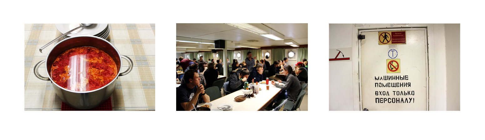
From left to right: A pot of borscht, a traditional Eastern European soup made from beetroot; MOSAiC scientists have lunch in the mess hall of the Akademik Fedorov; a safety sign in the corridor of the Akademik. Fedorov Credit: Daisy Dunne for Carbon Brief
The researchers who fill the cabins come from varied scientific disciplines: sea ice, atmosphere, ocean, ecosystem, biochemistry and geology. The aim of MOSAiC is to get these scientists taking measurements alongside each other, so that the links between their research may become easier to uncover, says Dr Matthew Shupe, co-leader of MOSAiC and an atmospheric scientist from the University of Colorado and the National Oceanic and Atmospheric Administration (NOAA). He says:
“We, the scientists, are disciplinary creatures. I study clouds in the atmosphere and so typically I’ll go to the field with some other atmospheric scientists. But it’s not enough for me to study the clouds in one part of the Arctic and somebody else to study the ecosystem somewhere else – because then we don’t know how they actually relate. So, here, we’re putting people together on the same ship to study those processes.”
The need for more interdisciplinary Arctic field research was one of the factors that led Shupe to come up with the concept for MOSAiC some 11 years ago. A couple of years later, he met Dr Klaus Dethloff, a climate modeller at AWI. “He had some similar ideas. He wanted to do an atmospheric study right out in the central Arctic with the Polarstern – and so, at that point, we joined forces.”
“I had the initial idea for a project that could improve climate models,” says Dethloff, who is also co-leader of the expedition. “The models are very bad [at representing] the polar region and that’s why I came up with this idea, with Matthew, to have this MOSAiC project – to gain high quality data and then, with the help of this data, endeavour to improve the models.”
Albedo: This is a measure of how much of the sun’s energy is reflected by a surface. It is derived from the Latin word albus, meaning white. Albedo is measured as a percentage or fraction of the sun’s energy that is reflected away. Snow and ice tend to have a higher albedo than, for example, soil, forests and open water.
Climate models are mathematical tools that scientists use to make projections about the Earth’s future. A major limitation with the models is that, in their simulations of the climate, they can make heavy-handed assumptions about small-scale processes in the Arctic, says Dethloff.
For example, during the summer months, warm temperatures can cause the sea ice to melt from above, leading to the formation of deep pools of water – known as melt ponds – on top of the ice surface. These ponds put pressure on the ice, increasing the chances of collapse. They also change the ice’s reflectiveness – or “albedo” – causing it to absorb more or less heat. Despite these impacts, some climate models do not include melt ponds in their simulations, or else assume that all melt ponds look and behave in the same way.
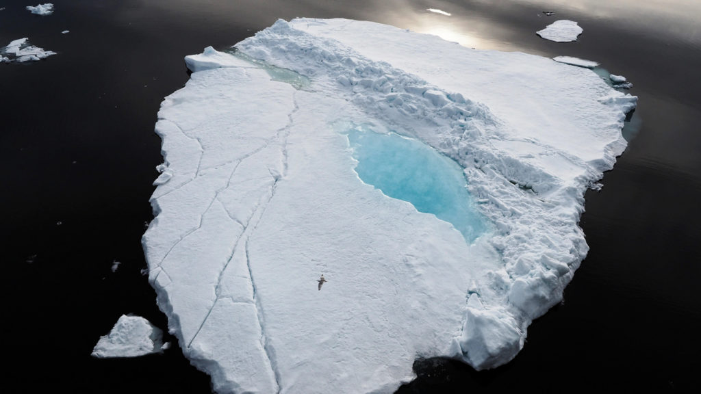
Ice floe with melt pond in the Arctic Ocean and flying ivory gull as size comparison. Credit: Nature2pix / Alamy Stock Photo
We see reductions in sea ice every year. It’s alarming.
One reason that climate models do not simulate small-scale processes well is because there is relatively little field data available that detail how these processes work. Or else, the available data only runs the course of a few weeks – the usual amount of time for an Arctic field study, Shupe says. By spending an entire year drifting in the sea ice, the MOSAiC team aim to collect more comprehensive data, which could, in time, be used to plug the gaps in climate models.
Another major focus of the expedition is to gain a better understanding of the impact that climate change is having on the Arctic.
“We see warming, we see reductions in sea ice every year. It’s alarming. It’s clear that there will be implications – what those implications are, we’ll find out,” says Dr Allison Fong, co-coordinator of the ecosystems research team for MOSAiC from AWI.
The Arctic is the most rapidly warming region on Earth. While the average global temperature has risen by around 1C since the start of the industrial era, the Arctic has seen at least twice this amount of warming. In some parts of the Arctic, temperatures have risen at a rate that is four times higher than the global average.
“The difference is obvious. You only need to look out the window to see climate change,” says Prof Markus Rex, the leader of the MOSAiC expedition. “In some parts of the Arctic, we now go by boat where we used to go with snow mobiles.”
The phenomenon of the Arctic warming at a faster rate than the global average is known as “Arctic amplification”. Research suggests there are a number of factors contributing to the effect, relating to interactions between the atmosphere, ocean and sea ice.
When you melt a bit of sea ice, you trigger a catastrophic cycle of positive feedback loops.
An example of such an interaction occurs when sea ice melts. Put broadly, climate change brings more heat to the Arctic’s atmosphere and ocean, causing sea ice to melt more rapidly. Sea ice is bright white and, so, reflects away incoming sunlight. When ice disappears, it uncovers the dark ocean, which absorbs a larger proportion of sunlight. This means that shrinking ice cover causes the Arctic to warm more rapidly, which, in turn, causes more sea ice to disappear. This interaction is known as the “ice-albedo feedback”.
“When you melt a bit of sea ice, you trigger a catastrophic cycle of positive feedback loops,” says Dr Michel Tsamados, a sea ice researcher from University College London taking part in the MOSAiC expedition. “Not all of these feedbacks are understood.” A major goal of MOSAiC is to learn more about these feedbacks – the steps involved, the timescales that they operate on and how climate change could be causing them to shift, he says.
From its starting point in Tromso, the Akademik Fedorov first heads north up past Svalbard before heading east across the top of Siberia. The view from the portholes is monotonous while the ship crosses the ocean, but researchers are treated to some Arctic spectacles.
On the first night at sea, the northern lights appear above the ship. Scientist gather on the upper decks to watch the white streaks move across the night’s sky. “If you look closely, you can see them dancing,” says Dr Jessie Creamean, an atmospheric scientist from Colorado State University who is leading a MOSAiC research project looking at the interactions between Arctic clouds and aerosols.
The northern lights occur when charged particles emitted by the sun penetrate the Earth’s magnetic field and collide with molecules in the atmosphere. These collisions result in the creation of little bursts of light, known as photons, which appear as colours across the night’s sky. The presence of the solar particles depends largely on the sun’s activity, making it difficult to predict when the northern lights will appear.
Two nights later, researchers rush to the ship’s stern after someone reports seeing spots of flashing fluorescence coming from the water below. A closer look over the back of the ship reveals thousands of tiny glowing microorganisms, which twinkle like fairy lights in the murky ocean.
MOSAiC scientists peer over the stern of the Akademik Fedorov to watch bioluminesce. Credit: Mario Hoppmann
In the days that follow, several theories emerge about what these creatures could be. Without access to the internet, it is impossible for the scientists to reach a firm conclusion. “My most likely guess is that they are bioluminescent copepods,” says Creamean. Copepods are a group of small crustaceans that are found throughout the world’s oceans. It is possible that the ploughing of the ship is disturbing the creatures, causing them to produce a bioluminescent stress signal, Creamean says.
The ship finally arrives at the sea ice six days into its voyage in the early hours of the morning at around 81 degrees latitude. Scientists wake from their bunks to watch the ice appear on the horizon. The ice close to the edge is only a few centimetres thick and riddled with fractures.
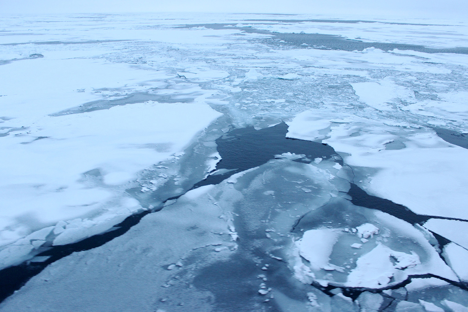
The view as the Akademik Fedorov makes its first contact with the sea ice in the early hours of the morning at 81 degrees latitude. Credit: Daisy Dunne for Carbon Brief
As the ship moves further north, the ice becomes thicker and harder to pass through. The sound of the boat crashing through particularly thick ice is loud enough to wake researchers from their sleep. “You can feel a vibration – a huge vibration – especially when you come through a big ice floe,” says Grigory Romanav, chief officer onboard the Akademik Fedorov.
Unlike the Polarstern, the Akademik Fedorov is technically not an icebreaker, Romanav says. To move through thick ice, the ship uses the might of its engines to ram forward in an attempt to break up the ice. If the ice remains intact, the ship reverses and then juts forward into the ice again. “You have to strike the ice again and again – and then, slowly, you’ll proceed,” he says.
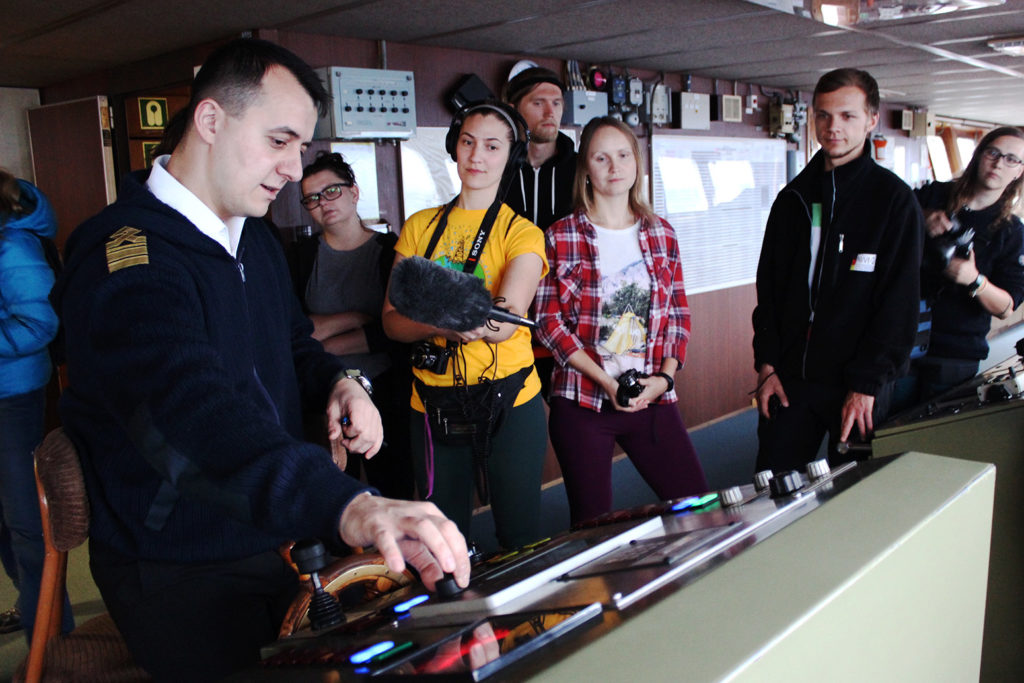
Grigory Romanav, chief officer onboard the Akademik Fedorov, demonstrates equipment on the bridge of the ship. Credit: Daisy Dunne for Carbon Brief
A floe to call home
As the ship forces its way through the sea ice, scientists get to work on the first major challenge of the expedition: finding a chunk of ice large enough to act as a base for the central camp.
Watching the ice drift past from the ship’s deck, it quickly becomes apparent that no two floes are the same. One moment, a field of round, flat chunks of ice will drift by – scientists call this “pancake ice”.
Seconds later, a layer of thin, almost translucent ice will come past, rippling with the vibrations caused by the ship’s forward motion. This kind of ice is known as “grease ice” – because it resembles an oil slick, says Daniel Watkins, a PhD student in sea ice from Oregon State University taking part in MOSAiC.
Sea ice over the Laptev Sea passing by the lower deck of the Akademik Fedorov. Credit: Daisy Dunne for Carbon Brief
The dramatic differences in the shape and size of ice floes come about at the time when the ice first forms above the seawater, he says. For example, if the waves are choppy, ice is more likely to form in the shape of a pancake, Watkins says. “That’s because, when you have more waves happening, the ice doesn’t have time to glue itself together. Instead, individual pieces keep bouncing off of each other – and that rounds them out.”
Sometimes, if conditions are right, ice floes can grow to be particularly thick and large, stretching several kilometres across. This can happen when several smaller ice fragments are pushed together in the winter, Watkins says. “Water starts to freeze in between the floes and it can act like glue, sticking the floes together. Then another floe will come and stick to it – and so it will grow.”
“It’s like walking through a forest. Some of the trees you see are small and some grow much taller than the rest,” says Prof Jari Haapala, a MOSAiC scientist who is head of the Marine Research Unit at the Finnish Meteorological Institute. “And we’re looking for the biggest tree of them all.”
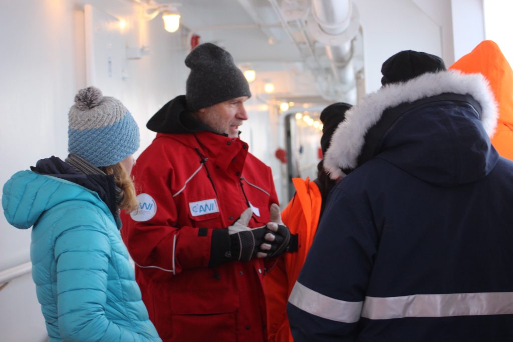
Prof Jari Haapala speaks with scientists on the deck of the Akademik Fedorov. Credit: Daisy Dunne for Carbon Brief
Haapala is part of a group of sea ice scientists spread across the Akademik Fedorov and the Polarstern who have been tasked with finding a floe suitable for the expedition’s main site.
The plan is for the Polarstern to drive into this floe, before switching off its engines and allowing itself to freeze in for the following year. The area surrounding the ship will then be used to set up a sprawling ice camp.
To achieve this, the scientists will need to find an ice floe that is thick enough to bear the weight of their heavy instruments – and large enough to support the plan for their multifaceted experimental site. The team hopes to install several “cities” on the ice surrounding the ship. Each “city” will be dedicated to measuring changes in one part of the Arctic climate system. For example, “ocean city” will use an array of instruments to measure features in the ocean below the ice floe, such as water temperature and salinity.

Graphic illustration of the MOSAiC ice camp set-up. Credit: Alfred Wegener Institute
The MOSAiC expedition is not the first to attempt an ice drift. In 1893, the Norwegian explorer Fridtjof Nansen pioneered this kind of field work, when he purposefully trapped the Fram, a Norweigan ship, in drifting sea ice in the hope that it would reach the north pole. The Fram drifted with the ice for nearly three years before emerging in open water near Svalbard, though it never passed over the north pole.
In 1937, a group of scientists from Soviet Russia were the first to establish a research base on a drifting ice floe. The Russian vessel that the researchers are travelling on is named after one of these scientists, the atmospheric researcher Evgeny Konstantinovich Fedorov.
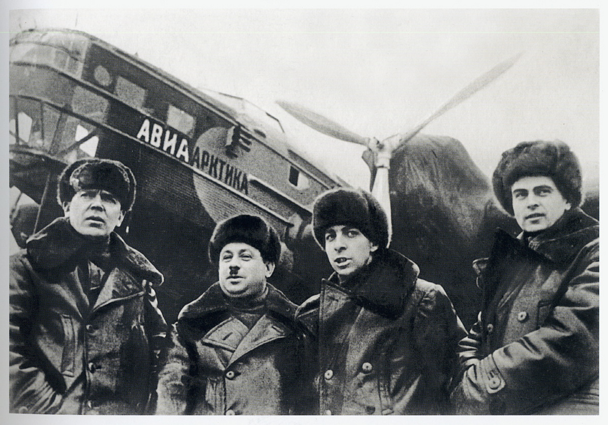
Soviet-era scientists at the first Arctic drifting station on 21 May, 1937. From left to right: Petr Shirshov, Ivan Papanin, Evgeny Konstantinovich Fedorov and Ernst Krenkel. Credit: Unknown
Over the next eight decades, Russian researchers went on to establish another 39 drifting research stations on the sea ice, before operations were shut down in 2013.
There are new dangers that are appearing now which we didn’t experience before.
“The Arctic has changed a lot. It has got a lot warmer. When it was colder, there was more ice and it was more stable. There are new dangers that are appearing now which we didn’t experience before,” says Dr Vladimir Sokolov, head of high-latitude expeditions at AARI and co-cruise leader on the Akademik Fedorov. (Sokolov spoke through the translator Dr Anne Morgenstern.) These dangers are what forced the ice drift operations to finish, says Sokolov, who was in charge of the last station.
To make the hunt for the floe easier, the researchers use satellite data. Satellites take regular grey-scale images of the sea ice from above, which are based on information from light sensors.
From these images, researchers search for spots of abnormality. A large black spot could indicate the presence of large floe, says Tsamados. “A dark spot indicates that the surface is very smooth. So, it could be that the area is smooth because it is one continuous floe rather than, let’s say, a field of pancake ice.”
On the other hand, areas of bright white indicate that the ice surface is unusually rough. This could mean that the ice in this area is rugged and thick – potentially thick enough to support the central base camp.
Using these satellite images, the researchers create a shortlist of potential sites close to the ship that might contain floes that are large and thick enough to meet the requirements for the central base camp.
Next, a group of researchers are sent out on the Mi-8 to survey the first potential site. Once the helicopter touches down, the group use drills to take ice thickness measurements.
The team are hoping to find an ice floe that is at least around one-metre thick, says Rex. “We would certainly be able to deal with an 80cm-thick floe, though that wouldn’t be perfect. Maybe we’ll get a one-metre floe, maybe 1.2m – that would be ideal.”
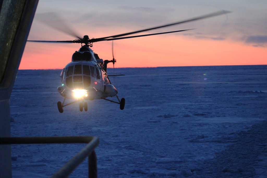
An Mi-8 helicopter lands on the helideck of the Akademik Fedorov. Credit: Daisy Dunne for Carbon Brief
However, the results from the survey of the first potential site undertaken by the team on Akademik Fedorov are disappointing. “The main thicknesses we measured there were 50, 60 and 70cm,” says Sokolov.
“I was surprised,” adds Haapala. “From the air it looks like a very nice floe.” However, once the researchers drilled down into the ice, it became clear that the floe was riddled by melt ponds, he says.
It is likely that the melt ponds first appeared during the summer, when warm temperatures caused the sea ice surface to melt. By autumn – the time of this voyage – cooler temperatures had caused the top of the melt ponds to freeze over, making them difficult to distinguish from the rest of the ice surface.
The presence of thin and pond-riddled ice reflects the broader changes seen in the Arctic in recent decades, says Shupe. “These floes are all Swiss cheese – there’s big holes all over them. This is how the Arctic is now.”
Since the early 1980s, the average thickness of Arctic sea ice has decreased by more than half. The total cover of sea ice across the Arctic Ocean has also declined sharply, with the last 13 years seeing the 13 smallest summer sea ice extents on record.
The back-to-back years of record melting has caused the average age of the ice to fall. In the 1980s, the majority of sea ice found in the Arctic was “multi-year ice” – ice that has persisted through at least one melt season. As ice ages, it has time to grow thicker and stronger. However, in today’s Arctic, ice is much less likely to survive from one year to the next. This has triggered a shift to an ice pack consisting largely of “first-year ice” – which is typically thinner and more prone to melting in the summer.
Changes in the extent of Arctic sea ice aged less than one year (light blue) to ice aged four years and over (dark blue) over time. Extent is shown for the same week (22-28 October) from 1985-2019. Data source: National Snow and Ice Data Center. Chart by Carbon Brief using Highcharts
The Arctic has shifted to be dominated by first-year ice over the last decade
“We won’t find a multi-year ice floe. The Arctic has shifted to be dominated by first-year ice over the last decade,” says Rex.
In the days that follow, research teams from both the Polarstern and the Akademik Fedorov visit several more potential floes to carry out more ice thickness surveys.
Three days into the search, the researchers strike lucky. The team from Polarstern have found a floe with an unusually thick centrepiece, says Rex:
“The floe we’ve selected has a core of very compressed and thick ice. Thickness in that area of the floe – which we’ve decided to call ‘the fortress’ – varies between four to five metres in many places and 1.5m in other places.”
This thick, rugged area is surrounded on either side by thinner, less stable ice. The total area of the floe is around two kilometres wide and three kilometres long. “We are going to use that fortress as the logistical hub for our operation,” says Rex.
Compromises will need to be made, however. The scientists had hoped to build a runway on the floe so that, in the depths of winter when the sea ice in the high northern latitudes will become too thick for ships to pass through, supplies could be delivered by air. However, the chosen floe’s thick centrepiece is too rugged to host a runway, and other, smoother parts of the floe are too thin to hold the weight of an aeroplane.
“The runway is, for sure, the greatest concern right now,” says Dr Marcel Nicolaus, a sea ice researcher at the AWI and co-cruise leader onboard Polarstern on the first leg of the expedition. “As it is right now, you could not land a plane here. But, within the next four months, there’s enough reason to assume that the existing ice will grow thick enough.”
If the ice that is chosen for the runway does not grow at a fast enough pace through the winter, the researchers may need to tinker with the thickening process, Nicolaus says. “It might happen that we need to do something to get the ice to grow faster than it usually would. For example, we could remove the snow.”
When snow sits on top of ice, it acts as a blanket, shielding the ice from the cold. Using a plough to clear the snow would, therefore, leave the ice more exposed, prompting it to thicken faster. “Another method could be to flood the surface with big water pumps and let it freeze over for a few days – and then repeat the process,” Nicolaus adds.
“Scientifically, it’s not what we were expecting,” says Shupe. “But I always knew coming in that we weren’t going to necessarily find an idealised version of an ice floe.”
Instruments on ice
Once the decision on the floe is made, the Polarstern and the Akademik Fedorov part ways and get to work on a new set of challenges.
For the Polarstern, the next major challenge is to drive into the ice floe and start the process of freezing in – without destroying it, says Nicholas:
“That’s certainly the next big step, to find a stable position for the ship and to manoeuvre it carefully so not break the ice floe. And then we will go out and do more surveys in order to define our real estate – to see where we could put the individual research stations.”
Meanwhile, the Akademik Fedorov starts work on its major task of the expedition: the setting up of the “distributed network” – a chain of research stations that will be installed on ice floes in a circle surrounding the central camp.
Each research station will feature an array of scientific equipment that, once deployed, will autonomously collect and send back data on changes to the sea ice, as well as the surrounding ocean and atmosphere.
Once completed, the central camp and the distributed network will roughly cover a 100 square kilometre (km2) area – the size of one “grid cell”, a single unit in a climate model.
A team of researchers are sent out on a helicopter to find ice floes that could be large and strong enough to support the network of research stations.
Next, the Akademik Fedorov drives to the first of these ice floes and moors itself to the floe’s edge. This is so the ship’s “gangway” – a heavy-duty metal staircase – can be lowered onto the ice.
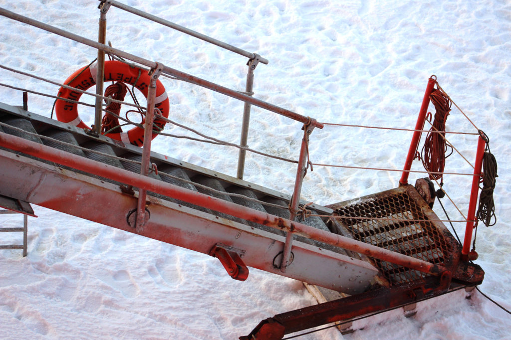
The gangway allowing passage from the Akademik Fedorov to the sea ice above the Central Arctic Ocean. Credit: Daisy Dunne for Carbon Brief
In the days that follow, the scientists work long hours in temperatures of between -10 and -15C to deploy their equipment on the ice. They are working against the clock. Every day, the number of daylight hours is decreasing. This is because the Arctic is edging towards “polar night” – a period last through the winter until next spring where the sun will not rise above the horizon, leaving the researchers in 24-hour darkness.
On the last day that the sun rises above the horizon, the research team get to work on the final major research station in the distributed network.
Dressed in fur-lined red suits and snow boots, the research team resemble astronauts as they step from the gangway onto the sea ice. To travel across the ice, scientists sit on wooden sleds that are pulled by snow mobiles.

A team of researchers take ice cores in front of the Akademik Fedorov in the Central Arctic Ocean. Credit: Daisy Dunne for Carbon Brief
The first major job is to drill holes – some up to 60cm-wide – through the sea ice to the ocean below. The holes are used to deploy instruments that will swim up and down the water column below the ice – or to hold ice-bound instruments in place, says Prof Ian Brooks, an atmospheric scientist from the University of Leeds taking part in MOSAiC. He says:
“You might think you can attach an instrument by securing it with a peg or screw and leaving it to freeze in. But, as soon as you put any stress onto the ice, it lowers the melting point and so, slowly over time, it will melt its way out.
“So, in order to put anything securely in place, you have to drill a hole all the way through the ice and, then, drop a bar down that is attached to a chain. It will fall out of the bottom of the ice and it falls horizontal and so you can’t pull it back up. That provides something that is really solid.”
The largest piece of equipment to be installed is what is known as an autonomous ocean flux buoy (AOFB), which uses a large array of sensors to detect little bursts of heat – known as heat fluxes – as they move between the ocean and the sea ice.
A group of scientists drill a hole through the sea ice in the Central Arctic Ocean. Credit: Daisy Dunne for Carbon Brief
“The way that the heat moves up and down the water column is really important because there’s lots and lots of heat in the ocean that, if it does get up to the surface, could do some major melting – and we really don’t quite understand how that’s all working right now,” explains Prof Tim Stanton, an oceanographer from the Naval Postgraduate School in California, who is leading the set-up of MOSAiC’s distributed network. Stanton designed the instrument himself and is using it to collect data for the first time during MOSAiC.
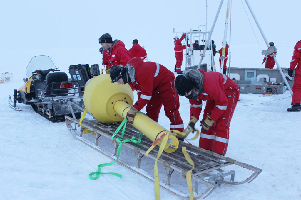
A yellow float, part of a specialised ocean buoy, is loaded off a snowmobile in the Central Arctic Ocean. Credit: Daisy Dunne for Carbon Brief
It’s exhausting.
But it’s what it takes to get the job done.
The instrument is brought to its deployment site in several parts – the largest being a fluorescent yellow float that will sit on top of the sea ice. When all the parts are put together, the instrument weighs 200kg, Stanton says.
Piecing the instrument together and lowering it into the ocean takes several hours. A team of four work in the bitter cold, sometimes removing their protective gloves to tighten screws with their bare hands. “It’s exhausting,” says Stanton. “But it’s what it takes to get the job done.”
As the scientists focus on setting up the instrument, they are watched over by a group of armed polar-bear guards, who stand at the edge of the research camp facing the horizon. The expedition leaders consider polar bears to be one of the largest threats to the safety of scientists taking part in the expedition – and, therefore, no researcher is allowed on to the sea ice without the protection of a guard.
A polar-bear guard watches the horizon in front of the bow of the Akademik Fedorov. Credit: Daisy Dunne for Carbon Brief
Each guard is dressed in high visibility clothing with an assault rifle slung over their shoulder. They stand in place for hours, scanning the all-white landscape for signs of movement. The first priority on seeing a polar bear would be to raise the alarm and safely evacuate the research station, explains Trude Hohle, a guard for MOSAiC. She says:
“If the bear was at a 150m distance, I would shoot a flare. But you’ve got to be a little bit careful with shooting flares, especially when if comes a bit closer because you could end up shooting above it and then it bangs behind the polar bear and so they run towards you.
“It’s hard to say when I would consider shooting a bear [with a rifle] because it depends on the situation. But, when I’m working, I will always create kind of an imaginary line and if the bear crosses that line, then it is, unfortunately – and I do not like using this phrase – a dead polar bear.”
Fortunately, the research team on Fedorov do not encounter any polar bears on the ice while they are setting up the distributed network – and manage to finish their experimental set-up with time to spare. The scientists on Polarstern, however, are not so lucky.
MOSAiC researchers set up scientific instruments as an Mi-8 helicopter flies overhead in the Central Arctic Ocean. Credit: Daisy Dunne for Carbon Brief
“There was a mother polar bear and its cub. We have seen them on several occasions here on Polarstern,” says Rex. “We did the standard procedure to chase them away so they don’t get used to living close to humans – that would be a situation that would be dangerous for both sides. We used flare guns and we used the helicopters.”
The Polarstern’s helicopters were sent out to fly towards the mother and cub, so that they would be scared away from the main ice camp. “That was efficient – we haven’t seen them for three and a half days now,” Rex adds.
A mother polar bear and her cub walk close by the Akademik Fedorov. Credit: Daisy Dunne for Carbon Brief
Frozen in
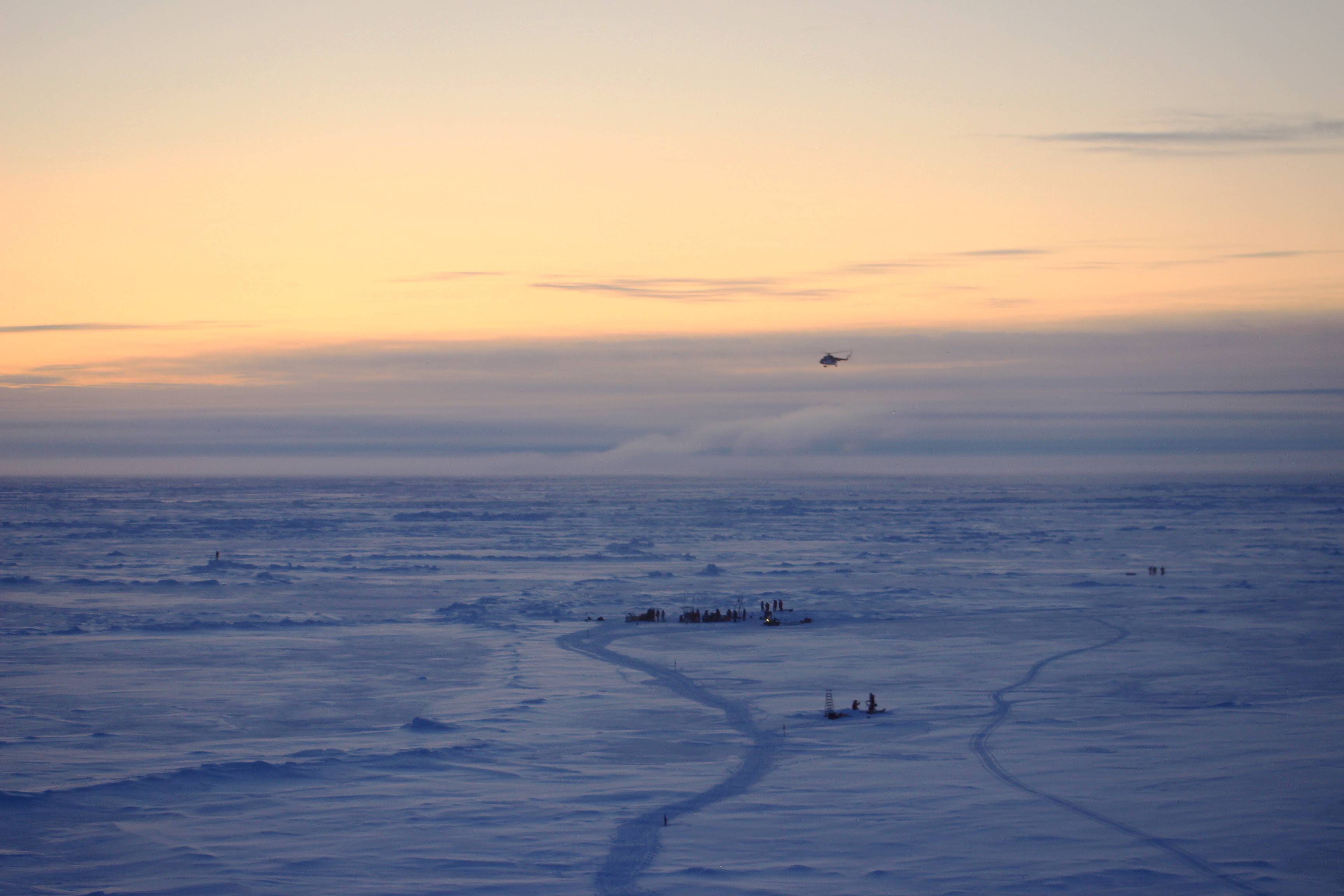
On the last day before the Akademik Fedorov is due to head back towards land, journalists are flown over to the main ice camp via helicopter.
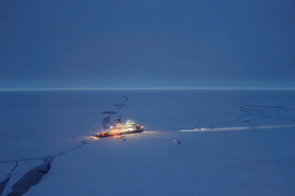
The Polarstern moored to an ice floe in the Central Arctic Ocean, as viewed from the window of an Mi-8 helicopter. Credit: Daisy Dunne for Carbon Brief
The Polarstern has successfully maneuvered itself into its chosen ice floe. It will still take several weeks before the ship becomes truly frozen in, however, Rex says, and so the team have secured it to the ice using a series of ropes that anchor the ship to the ice.
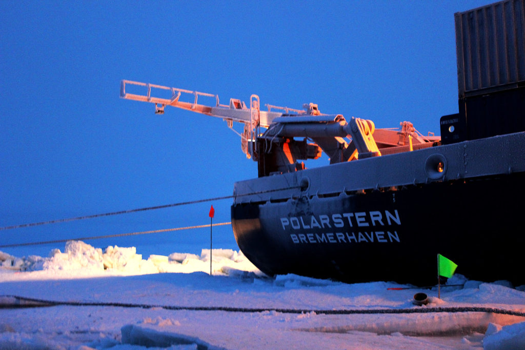
A series of ropes anchor the Polarstern to the sea ice in the Central Arctic Ocean. Credit: Daisy Dunne for Carbon Brief
In front of the ship, scientists have begun to set up the various “cities” that will make up the central ice camp. The researchers have installed a vast network of power cables so that instruments that are several kilometres away from Polarstern can stay connected. The cities are linked together through a network of narrow, fenced-off “roads”, which scientists traverse on snowmobiles.
At the camp’s most northern point, researchers have begun installing the “met city” – the part of the site that is dedicated to recording changes in the atmosphere surrounding the ice floe. The site’s distance from the rest of the camp means that it is eerily quiet – except for the regular chirping made by one of the atmospheric team’s instruments.
“That beeping noise you can hear is from the wind profiler,” says Shupe. The wind profiler is an instrument that regularly produces sound waves in order to measure wind speed, he explains.
As well as measuring changes in wind, the researchers have also set up instruments that measure changes in atmospheric radiation, as well as sea ice and snow cover. “Looking at changes in the atmosphere is one thing, but, ultimately, understanding the effect that those changes have on the sea ice is what will help us determine things like when the ice is going to melt,” Shupe says. “Looking at these things in tandem is really foundational to MOSAiC’s design.”
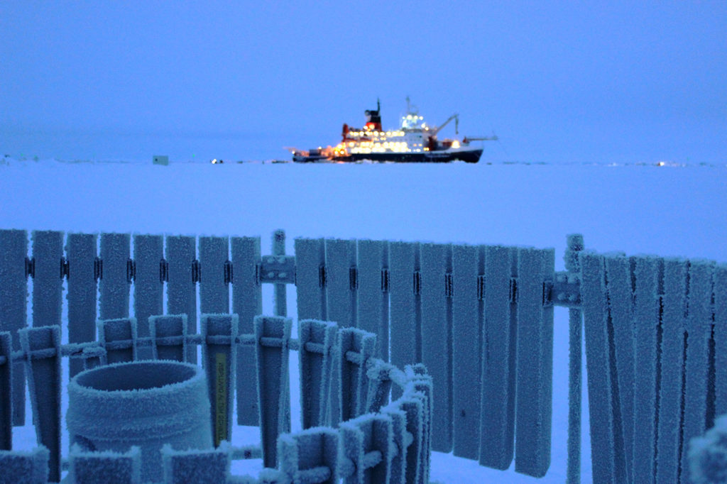
Foreground: A “precipitation bucket” – used to collect snowfall – surrounded by a windshield at MOSAiC’s “Met City”. Background: The Polarstern. Credit: Daisy Dunne for Carbon Brief
A big crack opened up right next to where we’d planned to put the tower.
The site’s centrepiece is a 30m-tall tower, which should be able to measure changes in the atmosphere at a greater height than the other instruments. For now, though, the tower is laying on its side on the ice. “A big crack opened up right next to where we’d planned to put the tower – so we’ve left it resting on its side for now,” explains Dave Costa, an electrical engineer working on the site’s installation from the University of Colorado and NOAA.
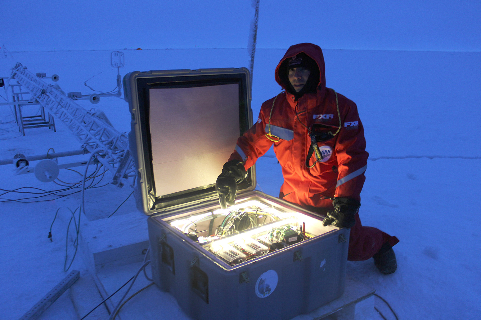
Engineer Dave Costa checks wires at the base of a 30m tower, which is laying on its side on the sea ice at Met City. Credit: Daisy Dunne for Carbon Brief
Closer to the ship, scientists have also begun work on the ocean and ice cities. There is much still to do, however, Rex explains. “We first need to plan our ice coring and sampling sites. Then we will work on setting up the trip wire.” The trip wire – another measure to ward off polar bears – is an electronic fence which will be installed around the perimeter of the ice camp, Rex says.
The remainder of this set-up work will have to take place in the following weeks, when the researchers will have to work in complete darkness. “People respond to polar night in very different ways. It’s always important to keep a structured day so you don’t lose your 24-hour cycle,” says Rex. “I personally love polar night. I know that I won’t be affected in a negative way – I just love it.”
MOSAiC’s “Ocean City” viewed in the darkness of polar night. Credit: Daisy Dunne for Carbon Brief
The winter could bring new challenges to polar bear guards, says Hohle. “It will be more difficult to see the bears. But we have some night vision binoculars to use.”
After winter ends, the next major challenge to the expedition will come in the summer months – starting from around May, when warming temperatures will cause the sea ice to begin to melt away. Summer warming will likely cause the melt ponds scattered across the sea ice to reopen – potentially creating new hazards, says Tsamados:
More broadly, there are social challenges that the expedition must grapple with. One issue is limiting the expedition’s environmental footprint. On its voyage across the Arctic, the Polarstern will be carried by the sea ice – an emissions-free mode of transport. However, it will still need to burn fuel for heat and electricity.
The expedition organisers estimate that, over the course of the expedition, this fuel burning will amount to 22,000 tonnes of CO2 – around the same amount produced in six hours by Germany’s largest coal plant. The estimate does not consider the fuel burnt by the expedition’s supporting vessels, such as the Akademik Fedorov.
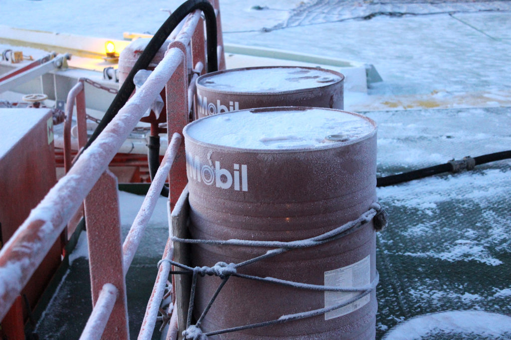
Cans of helicopter fuel on the helideck of the Akademik Fedorov. Credit: Daisy Dunne for Carbon Brief
Onboard the Akademik Fedorov, the environmental impact of the expedition and its participating scientists is a popular topic of conversation. A small group of expedition participants had sought to lower their carbon footprint by arriving in Tromso via train – an initiative started by Mauro Hermann, a climate science PhD student from ETH Zurich taking part in MOSAiC.
“It would have been easy to disappear under the radar and take the plane like everyone else. But time is running short and we have to address climate change altogether. It was the least we could do [to take the train] – and we had a good time,” Hermann says.
Another challenge facing the expedition is a lack of diversity among its participants. On the Akademik Fedorov, the gender split of expedition participants is 27% female to 73% male. Men also dominate leadership positions. On the expedition’s first leg, the two cruise leaders and two co-cruise leaders are all men. The Akademik Fedorov’s cruise leader, Dr Thomas Krumpen, who is also a sea ice researcher at AWI, says:
There could be more women and this was, of course, discussed. Polar research has always has been a bit male-dominated, but we see things changing now at AWI and this is something that we push hard for. However, this is something where progress won’t take place overnight.
The expedition’s third leg will be co-led by Dr Ellen Damm, a geosciences researcher from AWI, Krumpen adds.
The Akademik Fedorov arrives back in Tromso at the end of October after five weeks at sea. Scientists once more line the decks of the ship – this time to watch the spectacle of land appearing on the horizon.
The Polarstern, meanwhile, begins its year-long ice drift – initially veering south before starting to move towards the north pole. (It is possible to follow the ship’s location in real time.) Researchers on board will not see another ship until close to the end of the year, when they will be brought supplies by a second Russian vessel, the Kaptain Dranitsyn.
“We were told to bring something nice to wear for Christmas Day,” Creamean says. “Christmas on the sea ice will really be something special.”
The post Inside MOSAiC: How a year-long Arctic expedition is helping climate science appeared first on Carbon Brief.


