
Posted on 24 February 2017 by John Abraham
If you meet a group of climate scientists, and ask them how much sea levels will rise by say the year 2100, you will get a wide range of answers. But, those with most expertise in sea level rise will tell you perhaps 1 meter (a little over three feet). Then, they will immediately say, “but there is a lot of uncertainty on this estimate.” It doesn’t mean they aren’t certain there will be sea level rise – that is guaranteed as we add more heat in the oceans. Here, uncertainty means it could be a lot more or a little less.
Why are scientists not certain about how much the sea level will rise? Because there are processes that are occurring that have the potential for causing huge sea level rise, but we’re uncertain about how fast they will occur. Specifically, two very large sheets of ice sit atop Greenland and Antarctica. If those sheets melt, sea levels will rise hundreds of feet.
Parts of the ice sheets are melting, but how much will melt and how fast will the melting occur? Are we talking decades? Centuries? Millennia? Scientists really want to know the answer to this question. Not only is it interesting scientifically, but it has huge impacts on coastal planning.
One reason the answer to this question is illusive is that melting of ice sheets can occur from above (warm air and sunlight) or from below (warm ocean waters). In many instances, it’s the melting from below that is most significant – but this melting from below is really hard to measure.
With hope we will have a much clearer sense of ice sheet melting and sea level rise because of a new scientific endeavor that is part of a NASA project – Oceans Melting Greenland (OMG). This project has brought together some of the best oceanographers and ice experts in the world. The preliminary results are encouraging and are discussed in two recent publications here and here.
In the papers, the authors note that Greenland ice loss has increased substantially in recent decades. It now contributes approximately 1/3 to total sea level rise. The authors want to know whether this contribution will change over time and they recognize that underwater processes may be the most important to study. In fact, they note in their paper:
Specifically, our goal is improved understanding of how ocean hydrographic variability around the ice sheet impacts glacial melt rates, thinning and retreat.
In plain English, they want to know how water flow around Greenland affects the ice melt.
Their experiments are measuring a number of key attributes. First, yearly changes in the temperature of ocean water near Greenland. Second, the yearly changes to the glaciers on Greenland that extend into the ocean waters. Third, they are observing marine topography (the shape of the land underneath the ocean surface).
The sea floor shape is quite complicated, particularly near Greenland. Past glaciers carved deep troughs in the sea floor in some areas, allowing warm salty water to reach huge glaciers that are draining the ice sheet. As lead OMG investigator Josh Willis said:
What’s interesting about the waters around Greenland is that they are upside down. Warm, salty water, which is heavy, sits below a layer of cold, fresh water from the Arctic Ocean. That means the warm water is down deep, and glaciers sitting in deep water could be in trouble.
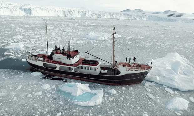
OMG research ship. Photograph: NASA
As the warm water attacks marine glaciers (glaciers that extend into the ocean), the ice tends to break and calve, retreating toward land. In some cases, the glaciers retreat until their grounding line coincides with the shore. But in other cases the undulating surface allows warm water to wear the glacier underside for long distances and thereby increase the risk of large calving events.
Oftentimes, when glaciers near the coast break off they uncork other ice that can then more easily flow into the oceans.


